Umm Yifenah Island Travel Hub: Bridge, Access & Nearby Stops
Umm Yifenah Island is a junction, not a holiday stop. Abu Dhabi’s official releases spell it Umm Yifeenah, and both spellings circulate, but the place is the same: a mangrove island between Al Reem Island and Sheikh Zayed bin Sultan Street, with the Mid-Island Parkway running across it.
You travel over the island rather than to it. The Umm Yifeenah Bridge opened on 9 February 2023, and a second road from Saadiyat Island is due to join it in 2027. The island has no hotels or attractions of its own, so what matters for a trip is how it links the places that do.
Umm Yifenah Island quick details
| Detail | Value |
|---|---|
| Spelling | Umm Yifeenah in official releases, Umm Yifenah in many searches |
| Type | Mangrove island carrying a highway and the Central Interchange |
| Connects | Al Reem Island, Sheikh Zayed bin Sultan Street and, from 2027, Saadiyat Island |
| Umm Yifeenah Bridge | 11 km highway, opened 9 February 2023 |
| Lanes & capacity | Six lanes, up to 6,000 vehicles per hour in each direction |
| Walking & cycling | Paths alongside the highway, plus bike rental facilities |
| On the island | No hotels, restaurants or visitor facilities |
| Part of | Mid-Island Parkway, Abu Dhabi Department of Municipalities and Transport |
What the island connects
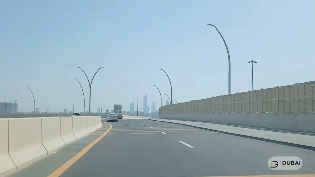
Two links are open, one is under construction and one is planned.
- Al Reem Island, open: the Umm Yifeenah Bridge crosses to it from the island.
- Sheikh Zayed bin Sultan Street, open: the bridge’s other end, which feeds traffic into Abu Dhabi’s main road network.
- Saadiyat Island, under construction: Phase One reaches the island’s Central Interchange in 2027.
- Al Raha Beach and Khalifa City, planned: Phase Two runs 14.5 km through Bilrimaid and Samaliyah Islands and Sas Al Nakhl.
Right now the drive from Saadiyat Island to Reem Island or Abu Dhabi Island takes about 25 minutes. Once the whole network runs, the two farthest points, Saadiyat Island and Zayed City, are expected to be just under 15 minutes apart.
Mid-Island Parkway phase one: Saadiyat to Umm Yifenah
The AED 2.85 billion first phase adds an eight-lane dual carriageway from Saadiyat Island to the Umm Yifeenah Island Central Interchange, and it is due for completion in 2027. It builds on the existing Saadiyat highway, which already reaches Saadiyat Lagoons, Saadiyat Marina District and NYU Abu Dhabi.
What the phase includes:
- 2 km of reclaimed land, protected by 150,000 square metres of rock to stop erosion
- 1.5 km of underground channel, including a 600 m underwater section 11 m deep beneath Khor Laffan
- 4 km of new walking and cycling track, joining Saadiyat’s existing path into a continuous 12 km route to Umm Yifenah Island
If your base is Saadiyat Island and your plans are on Reem Island or the main island, this is the link to wait for. It cuts the drive from about 25 minutes to about 10, roughly 15 minutes each way.
How the bridge was built around the mangroves
The Umm Yifeenah project is seven concrete bridges, two of them over open water for a combined 3.8 km. Precast concrete elements and arched causeways keep water moving through the wetland, hold navigation channels open for boats and let fish and other marine animals pass.
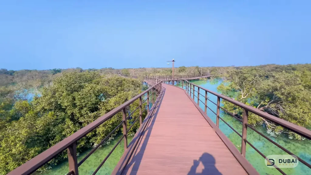
85% of the project’s materials were sourced locally, and mangroves were planted on nearby Jubail Island as part of the works.
Can you visit Umm Yifenah Island?
You can cross it by car, taxi or bike, but there is nowhere to stop, eat or stay on the island itself. The bridge project added walking and cycling paths alongside the highway and bike rental facilities. Beyond that, the island has no shops, restaurants or hotels.
Ways to reach the corridor:
- By car: join the Umm Yifeenah Bridge from Al Reem Island or from Sheikh Zayed bin Sultan Street and drive through.
- By taxi or ride-hailing: set Al Reem Island as your pickup or drop-off, since there is no stopping point on the island.
- On foot or by bike: use the paths that run alongside the carriageway.
Open the Umm Yifeenah Island map pin in any maps app to find where the bridge crosses.
Nearby places to use instead
Al Reem Island, Al Maryah Island, Saadiyat Island and Mangrove National Park cover the hotels, shopping, beaches and nature that Umm Yifenah Island lacks.
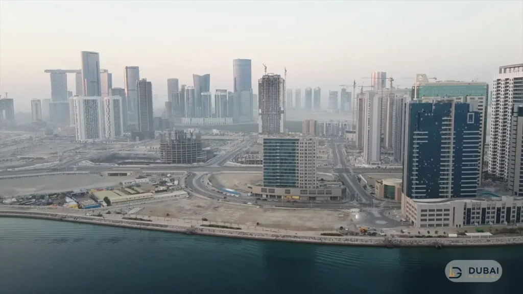
- Al Reem Island: residential towers, hotel apartments and Reem Mall, and the first stop after the bridge.
- Al Maryah Island: The Galleria Al Maryah Island for shopping and dining.
- Saadiyat Island: beaches, resorts and museums, and the island that gets 15 minutes closer to Reem Island when Phase One opens.
- Mangrove National Park: 19 sq km of protected mangrove close to Al Reem Island, with kayaking, stand-up paddleboarding and boat tours from operators such as Sea Hawk Water Sports and Noukhada. Tours run best at high tide.
Best time & safety on the corridor
November to March is the most comfortable stretch for walking or cycling the paths, while the summer months from June to September make midday exercise unpleasant. A few rules cover the rest:
- Keep to the paved paths. The mangrove edge is protected habitat.
- Never stop a vehicle on the carriageway. It is a six-lane highway carrying thousands of vehicles an hour.
- Carry water on the paths, since the island has no shops.
- Book kayak tours at Mangrove National Park around high tide, the best time on the water.
FAQ
Where is Umm Yifenah Island?
It sits between Al Reem Island and Sheikh Zayed bin Sultan Street, with the Umm Yifeenah Bridge running across it.
Is Umm Yifenah Island open to visitors?
The island has no hotels, restaurants or visitor facilities, so people pass through by road or along the walking and cycling paths rather than stopping.
Is Umm Yifenah the same as Umm Yifeenah?
Yes. Official Abu Dhabi releases use Umm Yifeenah, and Umm Yifenah is the common alternative spelling for the same island.
When does Mid-Island Parkway phase one open?
Phase One, the eight-lane link between Saadiyat Island and Umm Yifenah Island, is due for completion in 2027.
Can you walk or cycle on the Umm Yifeenah Bridge?
Yes. Walking and cycling paths run alongside the six-lane highway, and bike rental facilities came with the project.
Planning around the island
Use the island as a crossing, and pick your base from the places around it.
- Staying near the bridge: Al Reem Island, which the bridge connects directly.
- Beaches and museums: base on Saadiyat Island, and expect the Reem Island drive to drop to about 10 minutes after 2027.
- Nature: book a mangrove kayak or boat tour at Mangrove National Park around high tide.
- Walking or cycling: stay on the paths beside the highway and leave the mangroves untouched.