Dubai Metro Blue Line Map: Route, Stations & Opening Date
The Dubai Metro Blue Line map is shaped like a Y. One arm starts at Creek on the Green Line, the other at Centrepoint on the Red Line, and both meet at International City 1. A single line then continues east to Dubai Academic City.
The Roads & Transport Authority (RTA) is building 30 km of track with 14 stations. The line opens on 9 September 2029, twenty years to the day after the first Dubai Metro train ran.
No part of the map can be ridden yet. This guide takes each branch station by station, shows where the line plugs into today’s network, and sets out how far construction has got.
Dubai Metro Blue Line quick details
| Detail | Blue Line |
|---|---|
| Length | 30 km (14.5 km elevated, 15.5 km underground) |
| Stations | 14 (9 elevated, 5 underground) |
| Creek branch | 21 km, 10 stations, Creek to Academic City |
| Centrepoint branch | 9 km, 4 stations, Centrepoint to International City 1 |
| Interchanges | Creek (Green Line), Centrepoint (Red Line), International City 1 (between the two branches) |
| Depot | Al Ruwayyah 3 |
| Opening date | 9 September 2029 |
| Budget | AED 20.5 billion |
| Expected ridership | 200,000 a day by 2030, 320,000 a day by 2040 |
How the Y-shaped map works
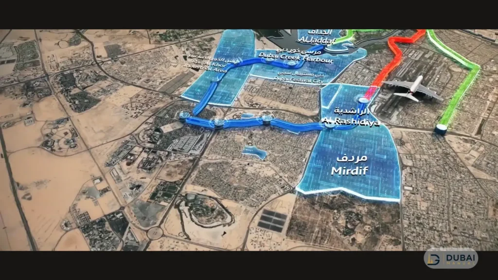
Two branches feed one shared line, and International City 1 is where they join. The Creek branch runs 21 km with 10 stations, and the Centrepoint branch runs 9 km with 4 stations.
Read the map from the two existing-line ends towards Academic City. The Creek and Centrepoint arms start at the Green and Red lines. The shared stem leaves International City 1 and carries on through International City 2 and 3 and Dubai Silicon Oasis to Academic City.
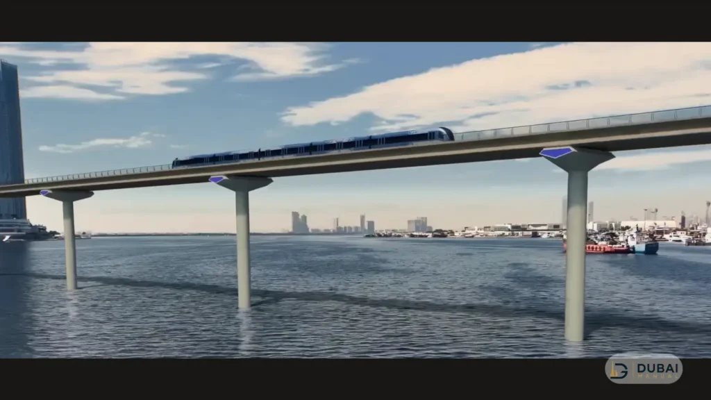
The Creek branch is also where the line crosses water. A 1.3 km viaduct takes trains over Dubai Creek between Al Jaddaf and Dubai Festival City, the first time any Dubai Metro line crosses the Creek.
The depot and maintenance facility for the line is at Al Ruwayyah 3.
Creek branch stations
The Creek branch has 10 stations over 21 km. The named stops, from the Green Line end to the terminus, are:
- Creek (Al Jaddaf), the interchange with the Green Line
- Dubai Festival City, a major development hub
- Dubai Creek Harbour, the Emaar Properties Station
- Ras Al Khor Industrial Area
- International City 1, where the Centrepoint branch joins
- International City 2
- International City 3
- Dubai Silicon Oasis
- Dubai Academic City, the eastern terminus
The three International City stops cover a community with the Chinese Market (Dragon Mart) and residential complexes for more than 200,000 residents and visitors. At the far end, Academic City gives more than 50,000 university students direct metro access.
Centrepoint branch stations
The Centrepoint branch has four stations over 9 km:
- Centrepoint (Al Rashidiya), the interchange with the Red Line
- Mirdif
- Al Warqa
- International City 1, the junction with the rest of the Blue Line
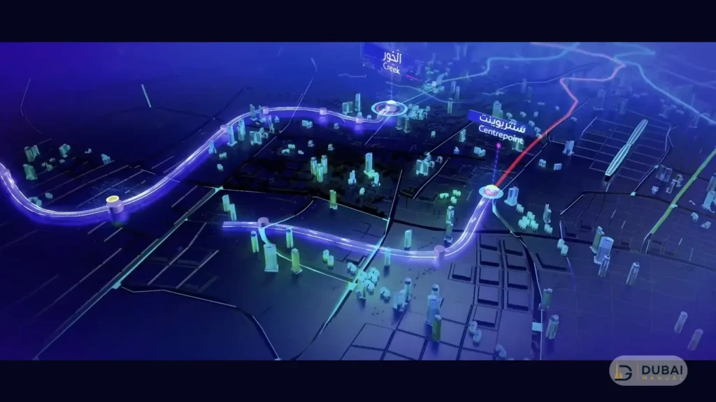
Interchanges & transfers
The Blue Line has three interchange stations, and only two of them connect to an existing line:
- Creek: links the Blue Line to the Green Line at Al Jaddaf.
- Centrepoint: links the Blue Line to the Red Line at Al Rashidiya.
- International City 1: joins the two Blue Line branches. No other line meets it.
Creek and Centrepoint are stations you can use today, so the current Red and Green line stations remain the way into the Blue Line until it opens.
Landmark stations on the map
Two stations stand out for their scale.
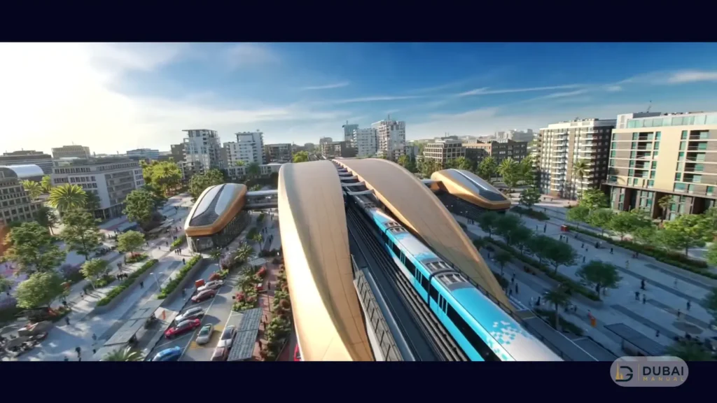
Dubai Creek Harbour station
Dubai Creek Harbour’s Emaar Properties Station will be 74 m tall, the tallest metro station in the world. Skidmore, Owings & Merrill, the firm behind the Burj Khalifa, designed it, and it covers about 11,000 sq m.
It serves a waterfront community of roughly 40,000 residents. Daily ridership is projected to pass 70,000 by 2040, and the station is built to handle up to 160,000 passengers a day.
International City 1 interchange
International City 1 will be the largest underground interchange station in the Dubai Metro network. It covers more than 44,000 sq m and is built for an estimated 350,000 passengers a day.
It is the connection point between the two branches, which makes it the hinge of the whole map.
Opening date & construction status
The Blue Line opens on 9 September 2029. Construction has moved through these stages so far:
| Date | Milestone |
|---|---|
| 24 November 2023 | Project approved by Sheikh Mohammed bin Rashid Al Maktoum |
| June 2025 | Groundbreaking |
| November 2025 | 10% complete, with work running at 12 sites |
| May 2026 | Tunnelling launched, with the project about 20% complete |
| July 2026 | First phase of tunnelling finished in two months |
| End of 2026 | RTA target of 30% complete |
| 9 September 2029 | Opening |
The tunnel boring machine completed a 1.2 km tunnel drive into the underground Dragon Mart station in July 2026. Its next section runs towards Al Warqa on the Centrepoint branch.
The RTA’s 30% completion target for the end of 2026 is the next public checkpoint.
Districts the line serves
The Blue Line connects nine districts to the metro: Dubai Creek Harbour, Dubai Festival City, Ras Al Khor Industrial Area, International City, Dubai Silicon Oasis, Academic City, Al Warqa, Mirdif and Al Rashidiya. The areas along the route are expected to house about one million people by 2040.
The RTA expects journeys between these districts and Dubai International Airport to take 10 to 25 minutes, and it projects a 20% drop in traffic congestion along the corridors the line serves.
The extension also grows the network. Total metro track goes from 101 km to 131 km, and the combined count of metro and tram stations rises from 64 to 78.
FAQ
When will the Dubai Metro Blue Line open?
The Blue Line opens on 9 September 2029, the 20th anniversary of the Dubai Metro’s first line.
How many stations are on the Blue Line?
The Blue Line has 14 stations, of which 9 are elevated and 5 are underground. Three of them are interchanges: Creek, Centrepoint and International City 1.
Where does the Blue Line start & end?
The line has two starting points, Creek on the Green Line and Centrepoint on the Red Line. Both branches meet at International City 1, and the combined line ends at Dubai Academic City.
Which stations connect to the Red & Green lines?
Centrepoint connects to the Red Line, and Creek connects to the Green Line. International City 1 only links the two Blue Line branches.
How long is the Dubai Creek crossing?
The viaduct over Dubai Creek is 1.3 km long. It is the first time a Dubai Metro line crosses the Creek.
Will the Blue Line go to Dubai International Airport?
The Blue Line has no station at the airport. The RTA expects journeys between the line’s nine districts and the airport to take 10 to 25 minutes.
How much will the Blue Line cost?
The Blue Line has a budget of AED 20.5 billion.
Planning around the Blue Line until 2029
Nothing on the Blue Line map carries passengers before 2029, so a few habits cover the wait:
- Plan trips on the existing Red and Green lines, and use Creek and Centrepoint, the two existing stations the Blue Line attaches to, as your starting points.
- Look at which branch a district sits on. Creek-branch stops run to Academic City on the 21 km route, while Mirdif and Al Warqa sit on the 9 km Centrepoint branch and join at International City 1.
- Track the 30% milestone at the end of 2026. It is the next date that shows whether work is on schedule for September 2029.