
Al Rabi Hiking Trail: Distance, Time & Parking
The Al Rabi Hiking Trail in Khorfakkan climbs to a 395 m summit and takes 2 to 3 hours to the first viewpoint and back, or 3 to 4 hours if you continue to the second summit. Entry is free, there is nothing to book, and the path is signposted from the start.
The trailhead is the Al Rabi Tower, a watchtower built in 1915 as part of Khorfakkan’s defence network. From there the route zigzags up the Hajar mountains above Khorfakkan Port and the Gulf of Oman.
Most of the planning comes down to three choices: how far to go, when to start, and where to park. The sections below cover each one.
Al Rabi Hiking Trail quick details
| Detail | Information |
|---|---|
| Location | Khorfakkan, Sharjah (east coast of the UAE) |
| Trailhead | Al Rabi Tower |
| Route type | Out and back on the same path |
| Distance | 4 to 5 km round trip to the first viewpoint; about 6 km to both summits |
| Time | 2 to 3 hours to the first viewpoint; 3 to 4 hours to both summits |
| Climb | About 370 m on the full route |
| Highest point | 395 m |
| Difficulty | Beginner-friendly in route finding, steady and exposed in effort |
| Entry | Free, no permit or booking |
| Parking | A few spots at the tower, more further down the hill |
| Best months | November to March |
How to get to the trailhead
Search for “Al Rabi Tower” in Google Maps and follow the pin to the Al Rabi Tower trailhead. From downtown Dubai the drive takes about 1.5 hours on the Sharjah to Khorfakkan highway, and a normal saloon car is enough. No 4×4 is needed.
Parking is the one real bottleneck. The few spaces beside the tower fill early, and Fridays are the busiest day. The larger parking area sits lower on the hill and adds an uphill walk before the trail proper begins.
If you are hiking with small children, drop them and one adult at the tower, then go and find a space.
Water and toilets are not available once the climb starts. Fill your bottles and use facilities in Khorfakkan town before you reach the trailhead.
The route stage by stage
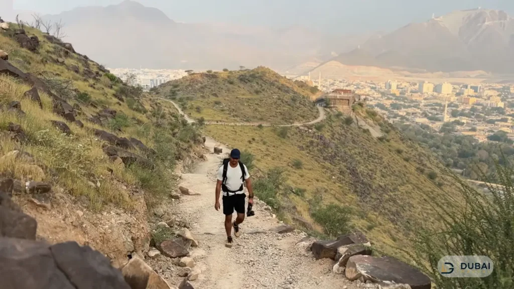
The trail is signposted throughout and the path is clear, so route finding is rarely the problem. The effort is. There is a constant ascent, loose rock underfoot and no shade at any point.
Tower to the first viewpoint
The first stretch is a zigzag of stone and gravel with information boards and rest stops. The climb to the first high point takes about 1.5 hours at a steady pace.
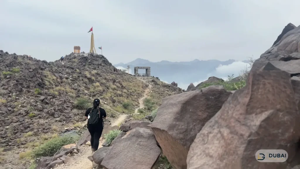
A UAE flag marks the top, with views over Khorfakkan city, the port and the water below. Sira Khorfakkan, also called Shark Island, is visible from the ridge, and boats to it leave from Khorfakkan Beach.
The dip & the rest area
Past the first viewpoint the trail drops downhill to a rest area before climbing again. The rest area has a prayer mat laid out with the qibla direction marked.
This is the usual place for a longer break, because the second climb starts straight after it.
The final climb to the summit
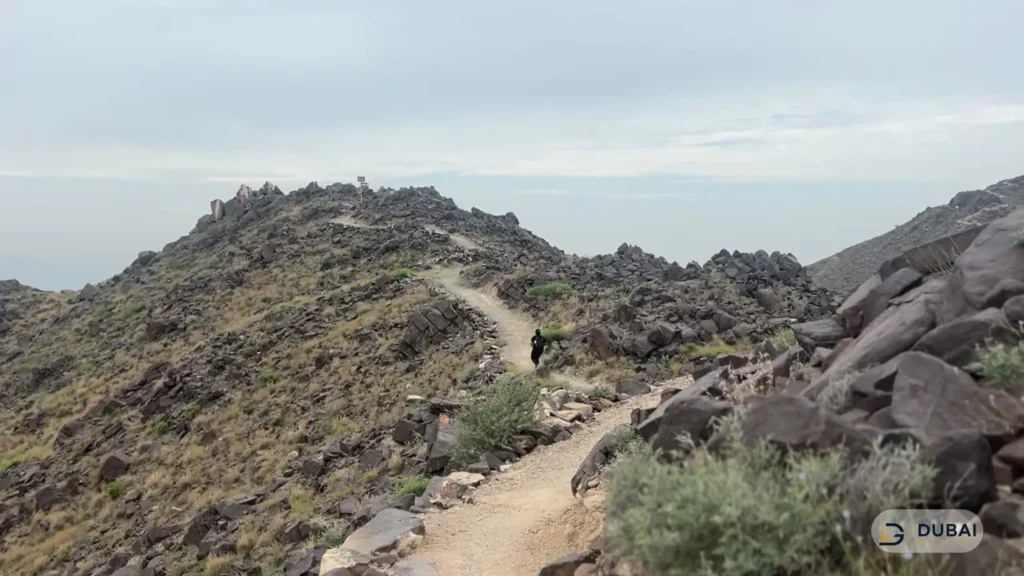
The last climb adds about 30 minutes and ends at the 395 m summit, also marked with a flag. The summit gives the widest view of the route, across the town, the harbour and the mountains behind it.
The descent
The way down follows the same path as the way up and takes about 1.5 hours from the summit. Loose gravel makes it slippery in places, so shoes with real grip matter more on the descent than on the climb.
First viewpoint or both summits
The first viewpoint is the right target if you are short on time, new to hiking or travelling with children. It is the 4 to 5 km, 2 to 3 hour version, and the views already cover the town and the sea.
Go on to the second summit if you have 3 to 4 hours, carry enough water, and want the full 6 km route. The extra effort buys the highest vantage point on the route, with a clear view over the town, the port and the mountains behind them.
Turning back is always an option. The views start early on the climb, so there is no penalty for stopping where you feel comfortable.
Best time to hike
November to March is the comfortable window, when a full day on the mountain is realistic. Summer months are best avoided, because the trail has no shade and the climb is continuous.
Within the day, start early or late:
- Morning: 6:00 AM to 7:30 AM puts you on the ridge before the strongest sun and gets you a parking space.
- Late afternoon: a start around 3:00 PM finishes near sunset, which suits cooler months.
- Before sunrise or after dark: the path is visible by moonlight, but a torch or headlamp makes the descent safer.
Fridays draw the biggest crowds. A weekday morning is the easiest day for parking and for having the path to yourself.
What to bring
- Water: 1.5 to 2 litres per person from December to March, and 2 to 3 litres in the warmer months.
- Footwear: hiking boots or trainers with good grip and no worn soles. Sandals and flip-flops are a bad idea on loose rock.
- Sun protection: hat, sunglasses and sunscreen, since none of the route is shaded.
- Food: salted snacks or fruit for the rest area.
- First aid: a small kit with plasters and insect bite cream.
- Light: a torch or headlamp for pre-sunrise starts or a sunset finish.
- Rubbish bag: everything you bring in comes back out with you.
Mobile signal is usually available on the climb, so a charged phone with the route saved offline covers most emergencies.
Safety on the trail
The trail is safe for beginners, but it is not a walk in the park. Four things catch people out:
- Heat and exposure: there is no shade, so a late start in warm weather can turn a 3-hour hike into a hard one.
- Loose rock: the gravel on steeper sections shifts underfoot, especially on the way down.
- Heights: some stretches run close to drops, so keep children within arm’s reach.
- No facilities: no refill points and no toilets once the climb begins.
Carry more water than you think you need, and turn back if the weather changes or anyone in the group is struggling.
Guided hike or self-guided
Self-guided works for most people. The path is marked, signal is reliable and the start is easy to find.
Guided group hikes suit first-timers who want a certified guide and optional transport from Dubai. Sessions run on set dates, usually as a morning or sunset hike, with adult prices starting around AED 200. The trade-off is a fixed schedule and a group pace, which frustrates hikers who prefer to set their own.
Where to go after the hike
Khorfakkan packs several easy stops into a short drive from the trailhead, which makes the hike a good base for a full day:
- Khorfakkan waterfall and amphitheatre: a free waterfall and the Khorfakkan Amphitheater, inspired by Roman designs, sit on the corniche.
- Khorfakkan Beach: a free public beach with parking, water sports and boat trips, set along the Khorfakkan Beach waterfront.
- Al Rafisah Dam: a lake and trail area in the mountains, and the dam trail is one of the walks around Najd Al Maqsar village.
- Old town cafés: a short walk around the old town near the fort area works well for a late lunch.
Parking near the waterfall and amphitheatre gets congested, so park on a side road and walk.
FAQ
Is the Al Rabi Hiking Trail difficult?
It is beginner-friendly but tiring. The route is clear and signposted, but the climb is continuous and exposed, so expect a workout over 2 to 4 hours.
How long does the Al Rabi Hiking Trail take?
The first viewpoint takes 2 to 3 hours round trip and the full route to both summits takes 3 to 4 hours. The climb to the first viewpoint alone takes about 1.5 hours.
Is there an entry fee or permit for Al Rabi Hiking Trail?
No. Entry is free, and there are no tickets, permits or bookings to arrange.
Where do I park for the Al Rabi Hiking Trail?
A few spaces sit beside Al Rabi Tower, and more are available lower down the hill. The tower spaces fill early, especially on Fridays.
Do I need a 4×4 to reach the trailhead?
No. A standard car reaches the trailhead without trouble.
Are there toilets or water on the trail?
No. There are no toilets or refill points once the climb begins, so prepare in Khorfakkan beforehand.
Can children hike the Al Rabi Hiking Trail?
Yes, many families do the first viewpoint section. Keep children close on exposed stretches and carry extra water.
Plan your hike
A short checklist for the day:
- Choose your target: the first viewpoint for 2 to 3 hours, or both summits for 3 to 4.
- Pick a start time between 6:00 AM and 7:30 AM, or around 3:00 PM for a sunset finish.
- Set the Al Rabi Tower pin in Google Maps and arrive early for tower parking.
- Pack 1.5 to 3 litres of water per person, grippy shoes and sun protection.
- Add a stop at the corniche, beach or dam after the descent.